Mining Image Mining Image Mining Image Mining Image

Retyped copy of original report


Officers
BARNEY ROLANDO - - - - - - - - - - - - - - - - - - - - - - - - - - - - - - - - - - - President
J. J. BECKER - - - - - - - - - - - - - - - - - - - - - - - - - - - - - - - - - - - - - - - - - Treasurer
G. W. LAIBLIN - - - - - - - - - - - - - - - - - - - - - - - - - - - - - - - - - - - - - - - Secretary
Main Office, Nome, Alaska


Nome
Gold Placer Mining Company
Incorporated under the Laws of Arizona


CAPITAL STOCK, $600,000


Branch Office, 136 South Broadway Los Angeles, California

Nome, Alaska, Oct. 20,1908


THE NOME GOLD PLACER MINING COMPANY, Nome, Alaska

Gentlemen:
Pursuant to your request I herewith submit my report of the affairs of the NOME GOLD PLACER MINING COMPANY, and a report of the work done on the property for the years of 1907-8.

Herewith also is appended a copy of the report of our surveyor and Engineer, J. A.
Dofilemyer, made in 1906.

Since the report of our Surveyor and Enginer was mad, considerable prospecting
has been done upon the benches on Sherrette creek, owned by our Company, and especially during last season. Beginning early last season, a drill was placed upon the properties and we have since then been continually engaged in prospecting the ground by drilling.

The formation of the benches as shown by the prospecting drill, is gravel deposit from the surface to bedrock, ranging in depth from 85 to 165 feet, the gravel carrying more or less gold from the surface down.

We have found as high as 10 cents to the pan on bedrock in the drill holes.
During last season values nmning 10 cents to the pan were found on the bedrock of the benches off of Sherrette creek, owned by the Company. The character of the ground is what is known as wet ground, and difficult to sink in. This being a dry season we have sunk a shaft beyond the wet ground, and are drifting into ground which shows values of 10 cents per pan, on bedrock. I will say that the prospecting upon the ground owned by our Company ahs been very extensive during the last two years, and the values shown by suck work are such that 1 am safe in saying that this ground can be mined by hydraulic methods with large profits.

The property of the Company consists of the following claims, to-wit: Lena Association; Milan Association; No.2, above; Mary Association; No.1, above; No.3, above; Lora Association; No.1, above upper discovery; Johnson discovery; Amelia Association; No.3, below; No.3 Y2, below; No.4, below; Lorenz Association; Becker Association; North Star Association; Piemonte Association; Clara Association; Emilla Association, and Blank Association, right limit Sherrette creek.

Regarding the work done on the property I will give you a brief estimate of the values found, but for the entire work done, you will find it in the proof of labor for last year, a copy of which I herewith attach. The proof of labor for 1908 is on file at the recorder's office, and I have not as yet received a copy of it.

On the lower end of the Lorenz Creek Claim there was an open cut of about 500 feet made, and the sluicing from that cut averaged $1.25 per yard. On the Emila Creek Claim an open cut of75 feet was made and the sluicing from it showed values from $1.25 to $2.50 per yard, and some large nuggets were found, one of which was valued at $200.00. On the Discovery Creek Claim an open cut was run about 60 feet and the sluicing from this showed values from $1.00 to $2.00 per yard. On the upper part ofNo. I a drill hole was sunk 85 feet, and gold was found all the way down to bedrock, and in good paying quantities. On No. 2 Creek Claim there have been four drill holes sunk to a depth of from 85 to 125 feet, showing good values all the way to bedrock, On No.3 Creek Claim an open cut was run about 100 feet and the sluicings from the cut showed values running $1.58 per yard. On the lower part of No. 4 five drill holes were sunk to a depth of from 40 to 47 feet to bedrock, showing good values all the way down. On the Mary bench claim there were sunk five drill holes to a depth of from 135 to 165 feet, good values being found all the way, and as high as 10 cents a pan at bedrock.

On the Lena bench claim a drill hole was sunk to the depth of 185 feet, but no bedrock was found, and the values on this claim were very light. On the Milan bench claim there were four drill holes sunk to a depth of from 95 to 155 feet to bedrock, showing good prospects, and pieces of gold were found to the value of 7 cents each. On No.2 a shaft was sunk to a depth of 78 feet to bedrock, on the right limit, and a cross cut was made for a distance of 200 feet on an incline of 40 per cent, and this showed good values all the way, with the exception of about 20 feet, and nuggets were found worth as high as 15 cents apiece. The gravel from this cut is still on the dump. A shaft was sunk on the Milan Association, late in the fall, to a depth of 74 feet, showing gold all the way down, but did not reach bedrock on the account of a broken pump. This shaft has the best showing in values that has been found on the property, panning showing a value of 5 cents a pan.


On the rest of the property there has been no work done except the annual assessment work required by the Government.


WATER

An option has been secured on a stream of water, about 10 miles from the property, and a ditch has been completed for about three miles in the direction of the property, leaving about seven miles of ditch yet to be built, which when completed to the property will give a flow of from 1000 to 1500 miners inches of water, which is an ample supply for hydraulic purposes. This ditch will almost pay for itself before reaching the property, by furnishing water to the adjoining property owners, who are willing to pay a good price for the same, as they all have gold, but few of them have the water to wash out the same.
In addition I desire to state that we have at least $30,000 worth of personal property on the ground at the present time, consisting of camps, camp equipments, drills, mining tools, iron sluice boxes, iron pipe, drilling machines, a team of horses, and a full and complete equipment for the propagation of the work.

In regard to capital, I desire to say that at an expense of from $100,000 to $125,000 water and all necessary machinery for hydraulic mining on a large scale could be placed on the ground, and from the nature of the property already tested, there could be taken out, at a very conservative estimate, at least $100,000 per month.

Very respectfully submitted,
BARNEY ROLANDO,
President and General Manager.


ENGINEER'S REPORT

To Barney Rolando, President; John J. Becker, Treasurer; E. Linton, Secretary, THE NOME GOLD PLACER MINING COMPANY, of NOME, ALASKA


Sirs:

In compliance with your request for a survey and a report on the Sherrette Creek Placers, I herewith submit the following remarks and the attached map as the result of said examination and survey.


INTRODUCTORY

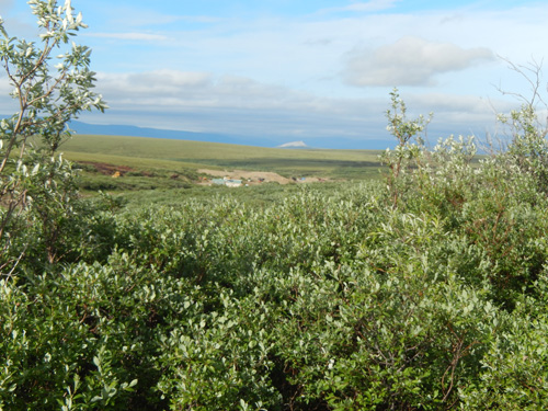
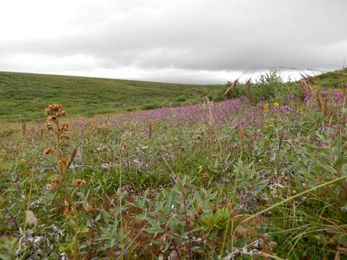
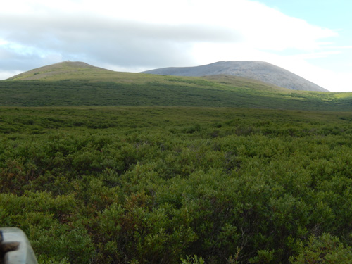
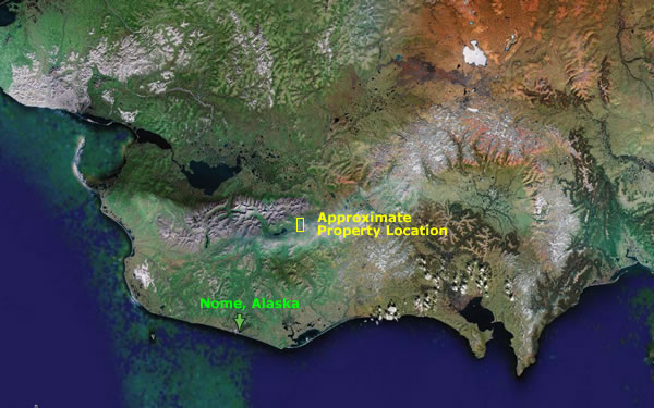
Sherrette Creek is situated in the Kougarok Mining District, District of Alaska, and on the completed line of the Seward Peninsula Railroad, 53 miles from the town of Nome, Iron Creek being the nearest shipping station, two miles distant, but at four miles north ofIron Creek the road crosses the Company's property.


Sherrette Creek rises on the north slope of the Iron mountains and flows in a northerly direction from about 10 miles, where it joins the Pilgrim River.


The upper two miles of the creek occupy a narrow deep canyon which it has cut into the bedrock, consisting of interbedden schists and limestones (the gold-bearing formation of the Seward Peninsula). After leaving the canyon proper the creek occupies a narrow shallow valley which it has cut out of the high gravel benches so characteristic of the Nome mining region. The lower stretches of the creek lie across a low gravel plain.


The records show that the Creek has been producing gold since 1904, but owing to the small amount of water available, no extensive mining has been attempted. The work performed by the NOME GOLD PLACER MINING COMPANY probably represents more that nine-tenths of all the improvements made since the Creek was discovered.


This work consists of surface working; the gravel all being moved by hand and amounts to about two thousand cubic yards of material passed through sluice boxes. The value of this being $1.25 per yard, on the Creek claims. This work as it shows on the ground, was done for the purpose of prospecting and not to make the largest recovery, thus giving an adequate knowledge of the average value per yard .


This work is all on the creek claims proper; no mining having been attempted on the benches other than doing the annual improvements required by law, but the surface pits all show encouraging prospects.


Bedrock has not been reached on any of the workings; the depth of the gravel is therefore not known.


SURVEY

A complete survey was made of the Company's property. The boundaries of each claim were accurately established by erecting permanent monuments; the total area of each claim ascertained and is shown on the accompanying map.


AREA

The total area of the Creek Claim proper, is 650.95 acres. The Bench Claim adjoining the Creek Claim, covering both limits and embrace an area of 699.06 acres as . surveyed, to which three locations of 160 acres each have since been added, making the total area of the Bench Claims 1,179.06 acres.


AMOUNT OF GROUND WORKED

All of the Creek Claims have been worked to some extent, the principal working being on the Emila and the Lora.


This work consists of surface cuts, and the number of yards moved on the Emila is 1,000; this ground showed a value per yard of $1.25. All the gravel carries gold, the richest being found on a clay bedrock. The work on the Lora consists of surface cuts. The prospects obtained showed a value of $1.25 pr yard; the richest gravel being found in a clay bedrock. Between the Emila and the Lora working, is a stretch of nearly two miles of creek which is certainly as rich as the ground already worked. Below the Emila, we can add one and a half miles of creek that has a good value.


It must be borne in mind that these claims are not mines, they have been only partly prospected, but the fact that the owners have spent several years in acquiring this territory, is evidence of their faith in the value of the property. To acquire mining lands in a region so remote from the base of supplies as this locality has been until the past season, when the building of the railroad was accomplished, required a considerable outlay of money and years of time.


THE BENCH CLAIMS

As stated elsewhere, no attempt has been made to mine on the bench claims other than to do the annual work, but enough has been done to show that they are gold bearing. The extensive gravel benches are mostly composed of local wash and they carry heavy
gold values.                           

                                 .
THE NOME GOLD PLACER MINING COMPANY propose to develop t6heir holdings by t6he use of water under pressure. The grade of the creek permits either the use of the ground sluice flume, or the hydraulic lift. The creek has a grade of two per cent.


RECAPITULATION

The large number of acres aggregating 1,830.01. The amount of development over 2,000 cubic yards, passed through sluices. The very satisfactory recovery which shows better that $1.25 per yard. The great depth of the overburden which ahs been proven to be gold
bearing. The extensive concentration which must have resulted from such a mass of graveL The bedrock conditions which are identical with other rich placer districts in the Seward Peninsula. Situated within two miles of a railroad in operation and in the center of one of the richest gold placer fields in the world where mining has passed beyond the prospective period and the district is actually sending out millions in gold each year, with an ever increasing production. It offers to those seeking mining investment, and opportunity to engage in an enterprise which bids fair to become a great profit producer.


Respectfully submitted,
J. A. DOFFLEMYRE, M.E.


Nome, Alaska, 1906


PROOF OF ANNUAL LABOR


UNITEP STATES OF AMERICA,
DISTRICT OF ALASKA.     S8.


Barney Rolando, being first duly sworn deposes and says: That he is the president of the Nome Gold Placer Mining Company, a corporation organized under the laws of Arizona; that said company owns those certain placer mining claims herein after described; that such claims lie contiguous and adjoining and are situate on Sherrette Creek and on the right and left limits thereof, which said creek is a tributary of Pilgrim River; said mining claims being in the Kougarok Mining and Recording District, District of Alaska; said claims are known and designated as folows:

  Acres
Lena Association Claim, left limit Sherrette Creek 160
Milan Association Claim, left limit Sherrette Creek 160
No.2 above Johnson Discovery Sherrette Creek... 20
Mary Association Claim, left limit Sherrette Creek 160
No.1 above Johnson Discovery, Sherrette Creek., 20
No.3 above Johnson Discovery, Sherrette Creek.. 20
Lora Association Claim, Sherrette Creek 160
No. 1 above upper Discovery, Sherrette Creek 20
Johnson Discovery, Sherrette Creek 20
Amelia Association Claim (on Sherrette Creek) 50
No.3 below Johnson Discovery, Sherrette Creek 20
No. 31/2 below Johnson Discovery, Sherrette Creek   20
No.4 below Johnson Discovery, Sherrette Creek 20
Lorenze Association Claim, Sherrette Creek 160
Schloh Association Claim, Sherrette Creek 160
Becker Association Claim, Sherrette Creek 160
North Star Association Claim, Sherrette Creek 160
Piemonte Assn. Claim, right limit Sherrette Creek   160
Clara Assn. Claim, right limit Sherrette Creek 160
Emilia Assn. Claim, right limit Sherrette Creek 160
Blank. Assn. Claim, right limit Sherrette Creek 160


That this affiant, who had charge of the field work for said company on said mining claims for the year 1907, had a crew of men and drilling and mining outfit, began work on said mining claims on the 4th day of July, 1907; that during said time and between said dates at least One Hundred Dollars ($100.00) worth of labor was performed and improvements made for the benefit and development of each of the said placer mining claims; that said work consisted of general prospecting, development and preparatory work. That on said Lena Association Claim a drill hole was sunk to a depth of 185 feet. That on said Milan Association Claim a drill hole was sunk: to a depth orl55 feet. That on said No, 2 above Johnson Discovery, a drill hole was sunk 95 feet in depth. That on said Mary Association Claim two drill holes were sunk, one 155 feet in depth and one 160 feet in depth. That on No.1 above Johnson Discovery, a drain ditch 300 feet long was cut. That on said Lora Association Claim a water ditch 450 feet in length was cut. That on Johnson Division, Sherrette Creek, a water ditch 200 feet in length 6x2 feet was cut. That on the Amelia Association Claim, Sherrette Creek, a water ditch 200 feet long was cut; also considerable wood was cut and piled on said claim for future drill and development work. That on No.3 below Johnson Discovery a water ditch 250 feet by 6 by 2 feet was cut. That on No. 31/2 below Johnson Discovery, building and camp improvements were made; also considerable wood was cut and piled on said claim for drilling purposes during the season of 1908 .. That on No.4 below Johnson Discovery, Sherrette Creek, considerable wood was cut, hauled and piled upon said claim for use during the season of 1908.


That on the Lorenz Association Claim a large amount of wood was cut, hauled
and piled for future drilling and development work.


That on the Schloh Association Claim. the folowing cuts were made: Cut No.1, 15x3x3 feet; cut No. 2, 17x4x4 feet; cut No. 3, lOx3112x3112 feet; cut No. 4,16x31/2x31/2 feet; cut No. 5, 16x3x3 feet; cut No. 6, 14x4x4 feet; cut No. 7, 8x4x4 feet; cut No.8 llx4xA feet; cut No.9, 12x4x4 f-eet. Also clearing ground of willows.


That on the Becker Association Claim the folowing cuts were made: Cut No.1, l1x31/2x31/2 feet; cut No.2, 13x31/2x31/2 feet; cut No.3, 19x31/2x31/2 feet; cut No.4, 16x4x4 feet; cut No.5, 12x4x4 feet; cut No.6, 13x4x4 feet. Also clearing said ground from willows.
That on the North Star Association Claim there was a cut 16x4x4 feet made, and also the cutting, hauling and piling of wood on said claim for drilling purposes during the year of 1908.
That on the Piemonte Association Claim, wood was cut, hauled and piled on said
claim for use during the season of 1908.


That on the Clara Association Claim, wood was cut, hauled and deposited upon said claim, and other drilling supplies placed thereon for use during the season of 1908.


That on the Amelia Association Claim, right limit Sherrette Creek, wood was cut and hauled and drilling supplies generally were placed on said claim for use during the season of 1908.


That on the Blank Association Claim, right limit Sherrette Creek, the representation work was done by the improvements begun and prosecuted on the water right and ditch on Libby Creek for the benefit of said claim.


That in addition to the above specified work on said claims, affiant and his said employees expended at least One Thousand Dollars ($1000.00) on the ditch and water right on Libby Creek in constructing a water ditch to convey water from said creek and intermediate creeks, to and on said claims above described for mining purposes. That said ditch has a carrying capacity of 1,500 miner's inches of water. That in addition to said work first shown above enumerated and said work and labor on said water ditch this affiant and said employes, did and performed a large amount of work in clearing and making wagon roads on and through the property for the purpose of hauling supplies and mining machinery thereon for mining purposes, at an expense of at least Two Hundred and Fifty Dollars ($250.OO).


That in the aggregate there was expended upon said contiguous mining claims during the year ending December 31 st, 1907, in general prospecting work, ditch building, road building on the claims, and for the annual labor thereon, the sum of at least Ten Thousand Seven Hundred Dolars ($10,700.00).


That said expenditure was made and said work was done at the instance and expense of the said Nome Gold Placer Mining Company, the owner of said claims.
BARNEY ROLANDO.


Subscribed and sworn to before me this 9th day of November, 1907.
Notary Public inand for the District of Alaska, Second Division.


THE NOME GOLD PLACER MINING COMPANY is organized under the laws of Arizona and its shares


Appendix C 1 - 1908 Prospectus Review

2006 Review of the 1908 Prospectus
of the Nome Gold Placer Mining Co.


The Nome Gold Placer Mining Co. (NGPM) and Peckenpaugh Mining Inc (PM) are on the same property. In 1908, NGPM control 1,830 acres ofSherette Creek and its contiguous benches. Today PM has a 1917, patent on 562 acres ofSherette Creek, with the remaining lands outlined by NGPM are currently unclaimed State of Alaska lands and open to mineral staking in 2007.


A considerable amount of prospect drilling was done from 1907 to?, ranging in depth from 40 to 185 feet The bedrock value of $.10 per pan, at today's gold price is $.10 x 180 pans per cubic yard (cy) x current gold price of $600 per Troy Oz (TO) divided by the 1908, gold price of $20 per ton = $540 per cy. Surface mining was recovering and average of $1.25 per cy or $37.50 at today's prices. All the drill holes but one indicated mineable values of gold. One shaft to a depth of 74 feet (not on bedrock) recovered $.05 per pan or $270 per cy.


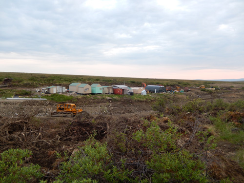
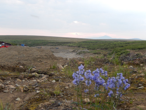
None of the benches were very mined other than to sink several shafts to bedrock and do some drift mining. The surface mining left a lot of unmined land and with modem recovery system must of the tailing maybe remitted. The largest portion of this property remains unmined, for what reason is unknown. The 1908, Prospectus verifies most if not all the assumptions Mr. Peckenpaugh made concerning this property over the years.


A claim staking program will be done by GPM in 2007, to tie up the remaining land outlined in the 1908 Prospectus. A geophysics and drill exploration program should be started this summer to verify the 1908 reserves, delineating more proven reserves for increase production and to provide the necessary data to develop a large scale mining plan. This can be done while production mining is progress with the equipment that GPM has on site, plus the equipment listed in the PM Information Memorandum.


An Alaska mining historical historian an other original claimant family members have been contacted to find any additional historical documents concerning this property.


Again this is an exciting property, which has already been undeveloped and overlook for the last 75 years.


Jon M. Peckenpaugh
President of PM/Mining Engineer


Appendix C 2 - Land Status

Land Status between the 1917 Nome Gold Placer Mining Co. Patent
and the 1908 Nome Gold Placer Mining Co. Prospectus Report


1914 Patent Survey (1917 Patent) Acres   1908 Prospectus (claims) Acres
         
No. Four Above (no patent) 16.204   No. 1 Above upper Discovery 20
No. Three Above 13.357   No. 3 Above Johnson Discovery 20
No. Two Above 13.628   No. 2 Above Johnson Discovery 20
No. One Above 16.026   No. 1 Above Johnson Discovery 20
Johnson's Discovery 15.923   Johnson Discovery 20
Omelia Mine 33.935   Amelia Association 50
same as     No.3 below Johnson Discovery 20
No. Three Below 14.479   No.3 below Johnson Discovery 20
No. Three-one half Below 15.036   No.4 below Johnson Discovery 20
NGPMC No. 1 & 3 80.000   Lorenze Association 160
same as     Becker Association 160
Lorenz Mine Placer 119.303   Schloh Association 160
same as     Lora Association 160
Becker Association 138.733   North Star Association 160
Schloh Association 149.129   Piemonte Assn., right limit 160
      Clara Assn., right limit 160
      Blank Assn., right limit 160


The Lora and North Star Association claims are along the upper Sherette Creek above the No. 1 Above upper Discovery' and Lora creek which flows into No. I Above upper Discovery (No. Four Above). The Piemonte, Clara, Emilia and Blank Assn., right limit claims are along the Eastside ofSherette Creek form the North Star in the South to the Lorenz Mine in the North.


The exact location of the above 1908 claims is not known at this time, but are all open to State of Alaska mining claims. A geophysical magnetometer survey along with drilling will delineate what areas should be reclaimed. As of yet, I have found no claims or assessment work being done on the Lena bench and Milan bench claims, but believe they are the additional claim locations described in the engineering report as three location of 160 acres each. These claims are believe to be located on the left limit (West side) ofSherette Creek between No. Four Above and the Mary Mine.


The No.4 Below is now two State of Alaska Mining Claims, NGPMC 1 & 3. The No.4 Above claim is believed to be the No.1 above upper Discovery and was included in the 1914 mineral survey, but not the 1917 patent.


As you can easily understand, the communications between the Mining Engineer; J .A. Dofflemyre in the 1906 report from Nome and the president, Barney Rolando's 1908 Prospectus in California, a lot of changes took place without each others knowledge.


In general all the ground talk: about in the 1908 Prospectus is owned by or adjacent to property owned or controlled by the Peckenpaugh Mining Inc. An exploration program in 2007 will define the areas needed and claim them for the PM Inc.


Jon M. Peckenpaugh
President/mining engineer

Map
Nome Web Cam Nome Web Cam

Camp Web Cam Camp Web Cam


[Most Recent Quotes from www.kitco.com]