

Mineral Report on Sherette Creek |
Summary
|
Geology
|
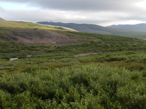
The Sherette Creek valley has been glaciated during the past ice ages. Typically glaciers have a destructive effect on the pre-existing placers. The glaciers most likely caused the separation of the west Sherette Creek from the east fork of Sherette Creek. The diversion happened in the general area of the Nome Gold Placer Mining Company's camp. This may explain why the old timers mined upper portions of west Sherette Creek without mining the lower portion. The richer paleo channel(s) went east beneath the saddle to join with the east fork. The gold presently in the lower west fork is stream reworked gold from a small portion of the rich upstream channels.
|
The large glacier from the Pilgrim River valley introduced the many large granitic boulders to the lower reaches of the Sherette Creek valley that are not seen upstream. The ice age glaciers have resulted in extensive changes to the landscape and its landforms.
|
Since the glaciers have melted away, solifluction has sculpted the valleys. Solifluction is frozen colluvium that slowly slides down from higher ground into a sub-arctic valley and fills it with permafrost. Today the most obvious indication of solifluction is the similarity of the straight and gentle valley slopes. The best evidence for it is simply frozen soil extending up slope from the lower edges of the local valleys. Another manifestation of solifluction is the deeply buried valley in the saddle between the east fork and the west fork of Sherette Creek. |
Bedrock is not exposed in or near the claim block. The substrate is glacial outwash which is usually finer grained gravel than the present stream gravel is. The substrate is sandy cobble gravel usually with some boulders and the occasional huge boulders. The glacial outwash gravel can be and frequently is gold bearing.
|
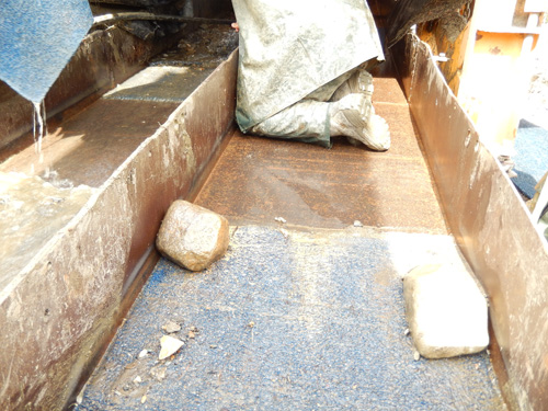
The present stream gravel (alluvium) is a boulder gravel with many boulders 2 to 4 feet in their dimension.
|
Mining History
|
This claim group was patented in 1917. Mining at that time in Alaska was much more expensive per ounce or cubic yard than today. Surface mining needed, at least, a quarter ounce per yard to be profitable to mine. Drift mining needed richer ground than this. (Efficient placer mining in Alaska today can be profitable mining only one hundredth of an ounce per yard.)
|
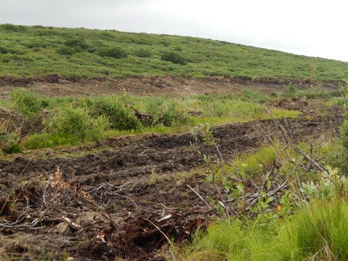
The old miners did not mine as far downstream as they apparently intended to get as evidenced by the preparatory ditches that they dug in advance of their mining. They may have constructed the ditches to dry out the alluvium, so they could mine more efficiently and comfortably. However they never mined more than the upper portions of this property. It is not known why they never mined the lower areas. This report proposes to mine some of what they prepared.
|
Mineral Resources and Reserves
|
The mineral resource in this Sherette Creek property is all the alluvium, tailings and the abandoned placer channels. The resources and the alluvium extends from above the claims to below the claim block. All of it has some gold, but it may to be too lean to be mined at today's gold price below the reserve block. The resource of the gravel above the claims were not determined in this investigation. Much of the alluvium upstream from the claims has been mined though. The tailings in this area were sampled near their lower end, but their tenor and quantity were not considered to adequate for more testing. Nevertheless there is some gold in the tailings.
|
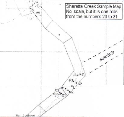
The mineral reserve is based on the sample data presented in the table below. This data comes from the investigation during the 2005 season. |
| Sample Number |
Sample Depth (ft) |
Mgs of Gold |
Boulder Factor* |
Grade (Toz. /bcy) |
Grade ** ($/bcy) |
Comments and Descriptions |
| J1a | 3-6 | 7.4 | .9 | .0026 | $1.18 | |
| J1b | 7-9 | 5.0 | .95 | .0002 | $0.84 | |
| 891 | 2.5 -5.5 | 305.3 | 1 | .1202 | $54.10 | Wet hole on line K (11) |
| 892 | 2-5.5 | 26.4 | 1 | .0104 | $4.68 | 50 ft to L.L. from 891 line K |
| K1a | 3-4 | 124.5 | .8 | .0392 | $17.65 | |
| K1b | 6 -8 | 46.0 | .8 | .0145 | $6.52 | |
| K2a | 5-6 | 54.4 | .75 | .0161 | $7.23 | |
| L1.a | 1 - 3 | 0.5 | :15 | .0000 | $0.07 | |
| M1a | 2-4 | 390.5 | .8 | .1230 | $55.36 | |
| M1b | 4-5 | 93.8 | .75 | .0277 | $12.47 | |
| M2a | 2-3 | 79.4 | .75 | .0234 | $10.55 | |
| M2b | 4-6 | 93.5 | .9 | .0331 | $14.91 | |
| N1a | 2.5 -7 | 3.7 | .9 | .0001 | $0.60 | Paleo channel sample |
| N1b | 8-9 | 7.4 | 1 | .0029 | $1.31 | Paleo channel sample |
| 01a | 6-7 | 8.5 | 1 | .0033 | $1.51 | 1640 mg nugget |
| 01b | 6-9 | 2.6 | 1 | .0010 | $0.46 | |
| 02a | 5-8 | 22.1 | .75 | .0087 | $3.92 | |
| 02b | 8 -10 | 1.5 | 1 | .0006 | $0.27 | |
| Average | 5.5 | .0239 | $10.76 | Without the nugget | ||
| 0-6 ft | $17.82/bcy is the grade in top | |||||
| Average | 3.5 | .0396 | $17.82 | 6 feet with out the nugget. |
* Boulder factor is the percentage of the sample material not Incorporated into the actual sample because the rocks are too big to handle safely. Normally the rocks are boulders larger than 10" in diameter. It is figured as 1 minus the percentage of boulders not sampled. If no boulders, it is simply the number one.
|
**This constant calculated by fineness (.980) X (1 + swell factor (.25» X $450 I 31103.5 X 0.1 Icy = .1772.
|
Examining the data above, it is clear that digging deeper than about six feet usually does not produce much additional gold. In fact, as a rule, it yields less gold in this block. Since no bedrock was ever encountered, there would be no bedrock concentration expected. Assuming the top foot is low yielding soil and vegetation, then the grade of $17.82 per bank cubic yard (bey) applies to a five foot column. The area in which these samples were taken is 18,163 square yards (sy). If you allow that there is 20% more ground outside the area bounded by the test pits as being represented by these samples; then it brings the total area to 21,838 sy. Multiplying this by 5 feet (1.67 yards) equals 36A69 bey. Since the average bank cubic yard in this block contains $17.82 worth of gold, then it is reasonable to conclude that $649,886 worth of gold lies buried in this small block of ground. There will be nuggets in this block that could significantly increase the value of this reserve.
|
The next question should be, "Is there likely to be more ground around like this?" My answer is "Yes, look deeper." It is possible that a bedrock concentration is possible on the bedrock surface. The depth of the surface may be shallow enough to mine and yield a significant additional resource.
|
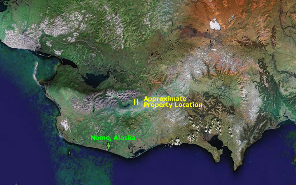
Additionally, there is most likely to be a rich old channel that the early day miners drifted on. It must have produced at least a quarter of a troy ounce per cubic yard. In my opinion missed segments of this rich channel still exist and they went through the saddle (see map above) to the east fork. It may be feasible to open pit mine for some distance before the overburden thickness makes too expensive to continue. These ancient abandoned placer channels hold the greatest potential for future development They could be rich and extensive, but difficult to find. I believe the buried channels veer off from west fork of Sherette Creek near the cabin. |
One of the first things this property needs is magnetometer surveys done to locate the old channels, especially the channel with the rich values. It is possible that paying channels may extend upstream and downstream from this block and our sampling program missed the narrow winding channel. The surveys should go up the east side of the valley several hundred feet because the greater values seem to be on that side and the abandoned channels are the east side. |
The land adjacent to these mining claims is State of Alaska and it is open for the staking of additional mining claims. |
Conclusion |
Jim Halloran |
My resume is presented in the following pages. |
RESUME |
OBJECTIVE |
QUALFICATIONS |
Prospecting for placers in both the glaciated and un-glaciated regions of Alaska . |
Evaluating known placer deposits and exploring for additional alluvial reserves . |
Interpreting aerial photographs, geologic reports, geophysical records, satellite imagery, topographic maps, etc. for landforms favorable to the accumulation of placer deposits . |
Preparing professional quality mineral reports. |
EDUCATION, CERTIFICATIONS, AND MEMBERSHIPS |
PROFESSIONAL EXPERIENCE |
1985 - 1986: Mining Geologist, Alaska Department of Natural Resources, Division of Mining, Anchorage. Advised the agency about geologic matters especially as they pertain to placer mining. Revised and critiqued all activities that would affect the minerals industry in Alaska. Developed a rapport with members of the mining industry by demonstrating my knowledge of prospecting, the origin of placer deposits, and mining law |
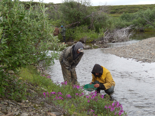
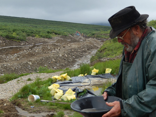
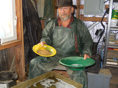
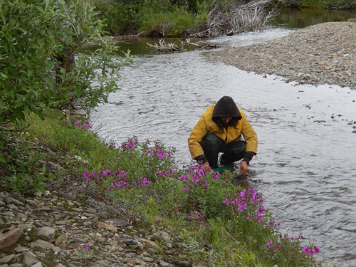
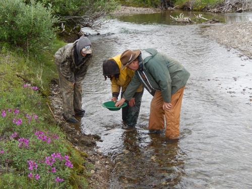
1981 - 1985: Consulting Placer Geologist, Anchorage. Explored for and evaluated placer deposits for clients. Interpreted aerial photographs and geomorphic terrains for landforms favorable to the gravity concentration of placer minerals. Sampled placer deposits with the resonant drill, reverse circulation rotary, excavators, and by hand shoveling. Concentrated the samples by using the Denver Gold Saver, EZ Panner, and the gold pan. Isolated the gold, weighed it, and calculated the grade of the ground. Calculated volume and grade of reserves. Conducted geophysical surveys using a proton magnetometer and refraction seismograph. Prepared professional quality mineral reports with maps, cross sections, photographs and tables. |
1977 - 1981: Minerals Geologist, U.S. Forest Service and Bureau of land Management, Anchorage. Conducted mining claim validity examinations. Worked closely with miners to get |
compliance with the laws. Reviewed mining plans and assisted miners with complying with their plans. Performed as an engineering geologist by mapping soils, landforms, and rock types. Served as a team leader on a high-level mineral development environmental impact report. |
1968-1977: Engineering Geologist, U.S. Department of Transportation, Federal Highway Administration, Denver. Colorado. Planned and conducted engineering geology investigations for roadways, bridges, and material sites. Drilled for data on foundation conditions, landslides. and aggregate resources. Conducted refraction seismic and resistivity geophysical surveys. Interpreted landforms for their potential for groundwater resources, and their suitability for structures. Used infrared, NASA, and ERTS imagery for environmental geology. Wrote reports for publication. Supervised a four-man field crew. |
PERSONAL |
REFERENCES References on request |
CONTACT: |
Jim Halloran |

![[Most Recent Quotes from www.kitco.com]](http://www.kitconet.com/charts/metals/gold/t24_au_en_usoz_2.gif)